
Transforming Construction with Drone Mapping & Project Updates
At Stout, we believe that leveraging the latest technology is essential for delivering exceptional construction management and client satisfaction. Our use of drone technology—especially through DroneDeploy—enables us to provide precise site mapping, track project progress, and deliver comprehensive documentation for construction projects.
Accurate Elevation Data and Earthwork Calculations
Stout uses DroneDeploy to create detailed site maps and elevation models. This technology enables us to:
Accurately map existing site elevations
Calculate precise earthwork quantities, including fill and cut requirements
Identify grading challenges before construction begins
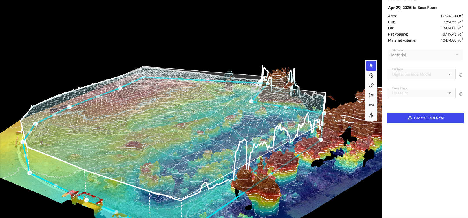
Drone elevation heat map of a site with 3D terrain generated using triangulated irregular networks (TINs) to accurately map elevation changes and calculate needed cut and fill. Red is higher elevation and blue is lower elevation.
By analyzing high-resolution drone imagery and 3D models, our team can determine exactly how much material needs to be moved, reducing surprises and change orders. This data-driven approach ensures that your project starts with a clear, actionable plan—saving time and money from day one.
Track Project Progress with Aerial Precision
Periodic drone flyovers give our team—and our clients—a literal bird’s-eye view of every stage of construction. By capturing high-resolution images and videos from above, we create a visual timeline that documents your project’s evolution from groundbreaking to completion. These visuals are a practical tool for:
Monitoring construction milestones
Comparing actual progress against schedules
Identifying potential bottlenecks or site issues early
Facilitating clear communication with stakeholders
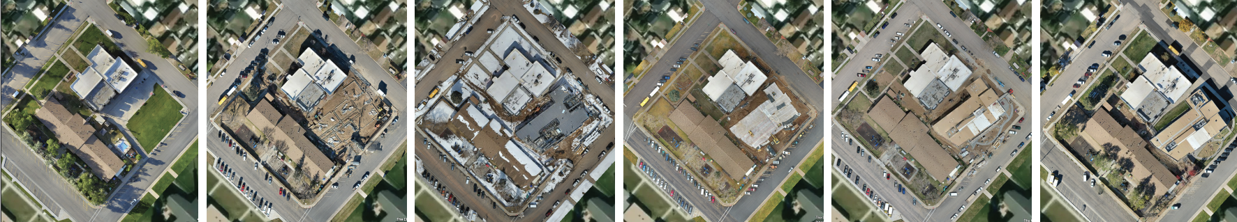
DroneDeploy images from our Evanston Childhood Development Center Project showing progress from preconstrcution to completed building and landscaping.
Clients appreciate seeing their project transform week by week. These visuals are integrated into project updates, meetings, and reports, providing transparency and peace of mind throughout the build.
Mitigate Liability with Comprehensive Site Documentation
Drones don’t just capture progress—they also document site conditions before, during, and after construction. This aerial record is invaluable for mitigating liability. By maintaining a detailed visual history of the site and its surroundings, we help protect our clients from potential disputes related to property boundaries, environmental impacts, or pre-existing conditions.
Drone imagery provides an objective record of property and neighboring areas at every stage, which is crucial for:
Addressing claims or concerns from neighbors or regulatory agencies
Supporting insurance documentation
Resolving questions about site access, deliveries, or incidents
A Client-Centric, Technology-Driven Approach
Stout’s commitment to innovation extends beyond drone services. We utilize Procore, a leading construction management platform, to give clients real-time access to project photos, documents, and updates. Drone imagery is seamlessly integrated into this system, ensuring that you’re always in the loop—no matter where you are.
Stout’s drone mapping and tracking services offer unmatched visibility and control of your project. Contact us today to learn how we can manage your next project.